SciPy Spatial Data
Working with Spatial Data
Spatial data refers to data that is represented in a geometric space.
E.g. points on a coordinate system.
We deal with spatial data problems on many tasks.
E.g. finding if a point is inside a boundary or not.
SciPy provides us with the module scipy.spatial, which has functions for working with spatial data.
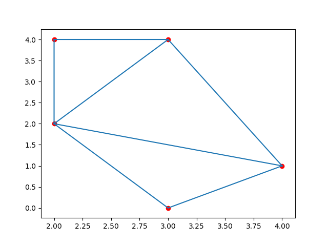
Triangulation
A Triangulation of a polygon is to divide the polygon into multiple triangles with which we can compute an area of the polygon.
A Triangulation with points means creating surface composed triangles in which all of the given points are on at least one vertex of any triangle in the surface.
One method to generate these triangulations through points is the Delaunay()
Triangulation.
Example
Create a triangulation from following points:
import numpy as np
from scipy.spatial import Delaunay
import matplotlib.pyplot as plt
points = np.array([
[2, 4],
[3, 4],
[3, 0],
[2, 2],
[4, 1]
])
simplices = Delaunay(points).simplices
plt.triplot(points[:, 0], points[:, 1], simplices)
plt.scatter(points[:, 0], points[:, 1], color='r')
plt.show()Result: